
Coastal intelligence services
Cosmeo’s services are based on three areas of environmental data production, covering coastal morphology, oceanographic dynamics and coastal ecosystems. A fourth, cross-cutting area is dedicated to the operational use of this data to support coastal management.

Coastal morphology

Sea conditions

Coastal ecosystems

Decision-making support
Coastal morphology
led by

co-contractor
The service provides coastline positioning data for the entire French coastline (mainland France and overseas territories), based on high- and very high-resolution optical satellite imagery, with comprehensive coverage of unspoilt coastal areas.
It enables the monitoring of coastal changes over time to support strategies for managing coastal erosion, coastal development and coastal risk prevention.
An operational processing chain is already in place and enables the production of these indicators. It is currently being scaled up to enhance its robustness, reproducibility and ability to adapt to all types of coastlines and coastal environments (beaches, cliffs, estuaries, etc.).
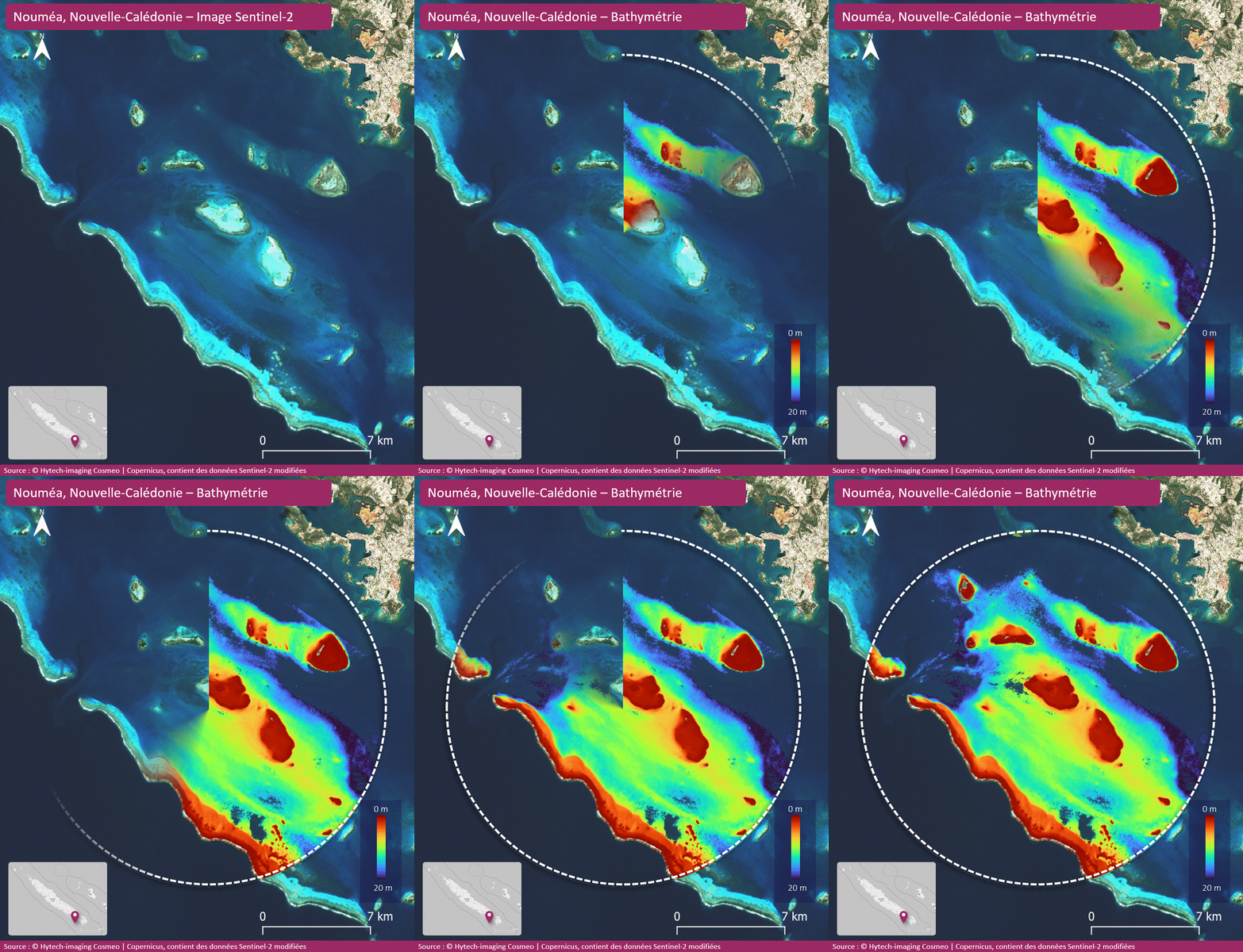
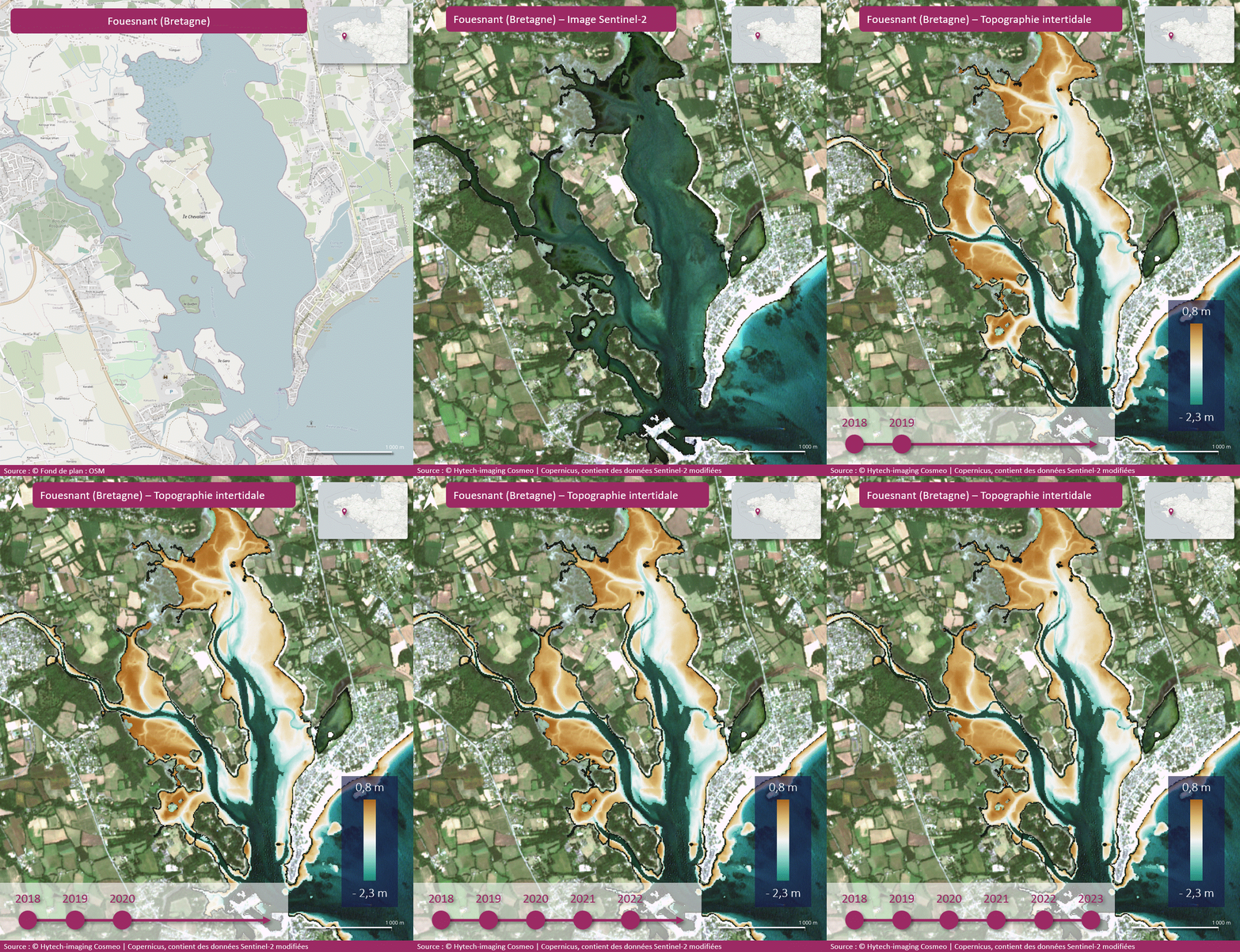
Pilot sites covered in 2026, demonstration available on request:
- Nouméa, New Caledonia
- Brittany
- Var and Alpes-Maritimes, Provence-Alpes-Côte d’Azur
- Rangiroa Atoll,Tuamotu Archipelago,French Polynesia
- Martinique
Sea conditions and coastal dynamics
led by

co-contractor

subcontractor

The service provides coastal surface current data every 3 hours or daily, depending on the geographical area, by combining marine current data derived from the analysis of AIS data, MELODI drifting buoys in near real time, and reference products from multi-mission satellite data and models.
Frequent updates and the availability of products in interoperable formats enable the service to meet the requirements for continuity and accuracy of maritime operators and the scientific community. The service guarantees rapid turnaround times, providing users with measurement data within a few hours.
Pilot sites covered in 2026, demonstration available on request:
- Mediterranean
- The West Indies – French Guiana
- Manche, Brittany, Bay of Biscay
- Reunion Island
- French Polynesia, New Caledonia
Coastal ecosystems
led by
co-contractor
subcontractor

The service provides habitat mapping products by combining earth observation data (high- and very high-resolution imagery), field data (vegetation surveys or habitat presence surveys) and artificial intelligence (AI).
This product provides up-to-date mapping of coastal habitats to support environmental monitoring, the management of marine protected areas and the assessment of pressures on natural environments.
Pilot sites covered in 2026, demonstration available on request:
- Morlaix Bay, Brittany
- Gulf of Morbihan, Brittany
- Quiberon, Brittany
- Lorient, Brittany
- Étel, Brittany
- Marin Bay, Martinique
Decision-making support
led by
co-contractor
subcontractor
Very high-resolution (VHR) satellite imagery, such as Pléiades, enables a better characterisation of boat traffic in marine protected areas (MPAs) and an assessment of the pressure exerted by moorings on seagrass beds.
Combined with AIS data and local information, these observations provide an integrated and objective view of recreational uses and their potential impacts on sensitive habitats.
The full set of data (maps, indicators) will feed into an operational dashboard, updated regularly, providing an objective and concise overview of the pressure exerted on sensitive habitats.
Pilot site covered in 2026, demonstration available on request: :
- Cap-Ferrat Marine Protected Area (Natura 2000 site)