Cosmeo: COPIL #2 meetings reaffirm the momentum of collaborative development and lay the groundwork for scaling up coastal services
Following the first steering committee meetings held in January 2026 to discuss the four thematic areas of the Cosmeo program, the collaborative development process with users continues. Recent highlights include a second series of steering committee meetings held in the spring and summer of 2026.
This milestone marks a significant development in the program’s trajectory: following an initial phase dedicated to gathering requirements, defining use cases, and finalizing the functional specifications for future services, the Cosmeo teams presented the first products and services developed at the pilot sites. These demonstrations paved the way for a new phase of co-creation with users, gathering their feedback on the results produced, how these could be integrated into business practices, and any adjustments needed before scaling up.
Following up on the first COPIL meetings in January 2026, this second series of meetings brought together all the regions involved, with sessions held in mainland France and in the overseas territories—notably in French Guiana, Guadeloupe, and Martinique—and soon in New Caledonia. This organizational approach made it possible to continue discussions with users in a manner closely aligned with local contexts, while maintaining a common framework for the collaborative development of Cosmeo services.
The four steering committees brought together program partners and future users to discuss the services developed in the areas of coastal morphology, ocean dynamics, ecosystem monitoring, and decision support.
Reminder of the Objectives
As a reminder, Lots 1 through 3 primarily focus on developing cartographic and ocean dynamics services based on monitoring products: some data will be updated regularly to track changes in the coastal zone (topography, bathymetry, coastline, habitat mapping), while others will enable more dynamic monitoring of physical and environmental conditions (surface currents, waves, cyclonic winds, dynamic topography, water quality, turbidity, chlorophyll, and indicators of the ecological status of ecosystems). The goal is to provide continuous access to this information, particularly through features integrated into the Littosat and OceanVibes platforms, in order to prioritize long-term monitoring and tracking rather than an approach limited to one-off analyses.
Lot 4 follows a complementary approach: it draws on this data to develop decision-support services, combining multiple sources of information to generate indicators, identify specific situations, or assist managers in making decisions. The four lots thus contribute to a comprehensive process, ranging from satellite observation to operational support for coastal stakeholders.
The discussions confirmed the interest in the services offered and the relevance of the approaches adopted to meet the needs of coastal stakeholders. They also provided a clearer picture of users’ expectations regarding accuracy, interpretation, and integration into their tools and practices.
Theme 1 – Satellite-Based Reference Systems for Monitoring Coastal Morphological Changes
The Lot 1 Steering Committee meeting provided an opportunity to present progress in three main areas: foreshore topography, shallow-water bathymetry, and the coastline.
The work confirms the potential of satellite imagery to produce consistent, regularly updated datasets that complement airborne data and field surveys. The goal is to provide reliable, interoperable data accompanied by information on their level of uncertainty, in order to support coastal change monitoring and risk management.
To monitor topography, the teams developed a digital elevation model of the foreshore based on the analysis of Sentinel-2 time series, combining satellite observations and tide levels. Initial results obtained at the Fouesnant pilot site show good consistency with reference data and open up new possibilities for monitoring erosion and accretion dynamics in intertidal zones.
The satellite bathymetry product for shallow waters has been tested at several pilot sites, covering nearly 5,000 km², notably in Nouméa, Bora Bora, and southern Finistère. Performance varies depending on seafloor characteristics, with particularly encouraging results in areas with clear waters. The production of data over a large area in Nouméa (3,000 km²) validated a key step in the upscaling process. Work is now continuing to enhance the robustness of the methods and to develop a continuous topographic-bathymetric product linking the foreshore to shallow waters.

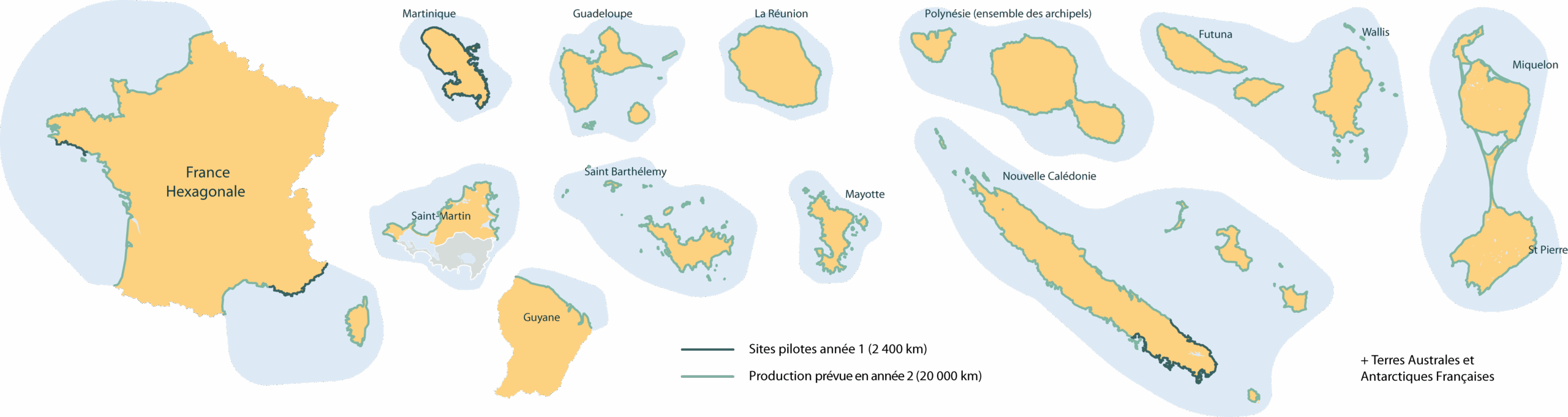
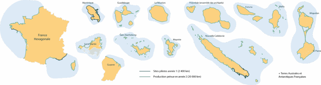
The coastline monitoring product is also entering a preparatory phase for nationwide implementation. The processing workflows have been optimized to enable annual data production covering more than 20,000 kilometers of coastline in mainland France and its overseas territories. Tests conducted in a variety of environments—including sandy and rocky coasts, reefs, and mangroves—have helped identify the adjustments needed before a widespread deployment.
The initial products were shared with several users associated with the pilot sites to gather their feedback on expected uses, required levels of accuracy, and data access procedures. These discussions with key stakeholders such as SHOM, BRGM, and IGN help refine the services before they are expanded to new areas.
Theme 2 – Enhanced ocean observations to characterize coastal dynamics
The Lot 2 Steering Committee presented the initial results from ETAMAC's services dedicated to monitoring surface currents, waves, dynamic topography, and cyclonic winds.
The goal is to provide consistent, high-quality, and immediately usable products that combine satellite observations with in situ measurements. The services developed include visualizable data, downloadable datasets, time series, and quality indicators.
In particular, the wave service presented its initial results. The validation tests conducted show good consistency in the observed swell parameters, paving the way for the development of services to monitor and forecast swell arrivals in coastal areas.
The future MELODI drifting buoy network is a major focus of development. Discussions with users—including Météo France, IRD, and Ifremer—will help identify priority observation areas, expected data acquisition frequencies, and potential partnerships with maritime operators, monitoring infrastructure providers, or scientific organizations.
Participants also learned about the features of the Ocean Vibes platform: interactive visualization, time-series extraction, data downloads, and access to quality indicators. These tools will be gradually enhanced to meet the needs of different users.
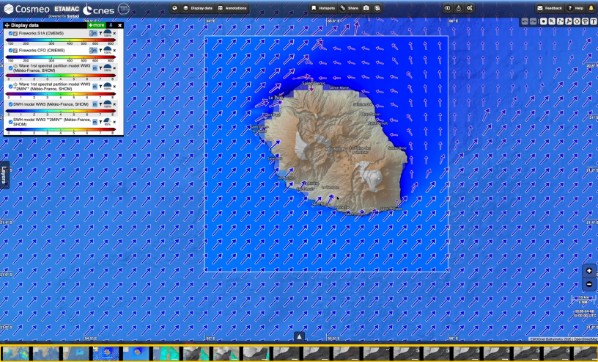
For the Surface Current and Dynamic Topography service, work is progressing toward the development of operational products that incorporate confidence levels and quality information designed to support business applications. The next steps will focus on consolidating validations and preparing for the first deployments.
Theme 3 – Satellite Indicators for Monitoring Water Quality and the State of Ecosystems
The Lot 3 Steering Committee focused on three categories of services: water quality monitoring, habitat mapping, and monitoring the ecological status of ecosystems.
Water quality studies aim to provide regular indicators for several parameters that are essential for monitoring coastal environments: suspended solids (SS), which are associated with turbidity, and chlorophyll (CHL), which is associated with phytoplankton biomass.
A case study focusing on a phytoplankton bloom and turbidity plumes in Vilaine Bay (Brittany, France) allowed for a comparison of various satellite sources, ranging from the public Sentinel-2 and Sentinel-3 missions to high-resolution data from the commercial Planet SuperDove constellation. The results demonstrate the value of combining observation frequency and spatial resolution to characterize complex coastal phenomena, particularly in environments with high turbidity. Two complementary approaches are proposed: a regular, large-scale monitoring product and more detailed products that can be deployed for specific events.
The habitat mapping service has been deployed at several pilot sites in Brittany (Morlaix Bay, Gulf of Morbihan, Lorient, Quiberon) and in Martinique (Marin Bay). The methods developed combine machine learning, Sentinel-2 and Pléiades imagery, as well as reference data provided by local and national stakeholders. The initial results enable the characterization of various marine and coastal habitats, with the goal of achieving the level of detail specified by the EUNIS framework (2022, Level 3) whenever possible, while also providing associated confidence and fragmentation indices. The average overall accuracy of these results is 87%, indicating a high level of confidence in this work.
These maps are now being evaluated based on user feedback in order to improve the classifications, refine the limits of the methods, and clarify the conditions for operational use.
Finally, the development of the ivi-S2 indicator (derived from Sentinel-2 imagery) aims to track changes in intertidal ecosystems over time by providing comprehensive and continuous information on the vegetation and biological dynamics of the foreshore. The innovation lies in the creation of a shallow-water vegetation indicator, making it possible to analyze images in which the intertidal zone is partially submerged. Discussions have confirmed the value of cross-referencing these indicators with habitat maps to improve our understanding of the ecological status of coastal environments.
Theme 4 – Turning Data into Decision-Making Tools
Lot 4 has an additional objective: to transform the data produced by the other three lots into services that managers can use directly.
The services focus on three main areas: land-use management in marine protected areas, coastal risk monitoring, and support for maritime planning.
In marine protected areas, the first pilot projects focus on monitoring recreational boating and shellfish farming activities. At the pilot site in Saint-Jean-Cap-Ferrat (Provence-Alpes-Côte-d’Azur), the water-based recreational activity monitoring service uses Pléiades imagery and supplementary data to generate indicators on usage, anchorage, physical pressure, and the risk of potential impact on sensitive habitats.
The prototype was presented to the managers of the marine protected area to gather their feedback on relevant indicators and how to use the tool. The goal is to develop a tool to support the management and regulation of land uses, which will be gradually rolled out to other Mediterranean MPAs.
In the Gulf of Morbihan, research on shellfish farming aims to characterize the interactions between oyster farming activities and sensitive habitats. The initial results were discussed with the relevant stakeholders (OFB and the Gulf of Morbihan Regional Nature Park) to identify the most relevant indicators for assisting in the management of concessions and the improvements needed before the data can be put to operational use.
With regard to coastal risks, the teams presented their initial work on modeling marine inundation scenarios, combining sea-level rise, ground movement, extreme events, and topographic data. The goal is to provide visualization and analysis tools tailored to the needs of local governments and coastal management stakeholders.
Work on the marine planning component—currently in the design phase—is focused on defining the scope of the future prototype and preparing for the integration of Cosmeo data. Its development will gradually draw on data from the “morphodynamics,” “ocean dynamics,” and “ecosystems” components.
Another step toward services developed in partnership with local communities
These COPIL #2 meetings confirm the growing maturity of the services developed within Cosmeo and the program’s ability to gradually transition from product development to demonstration and then to large-scale deployment.
They also illustrate one of Cosmeo’s founding principles: building services in collaboration with their future users. From the initial needs identified through to the evaluation and adoption of prototypes, the feedback gathered from pilot sites enables us to gradually improve the solutions so that they meet the expectations of coastal stakeholders as closely as possible.
This momentum was reinforced by the CNES and the French government’s approval of the completion of the program’s first year and by the confirmation of funding for a second year of demonstration.
The coming months will be devoted to consolidating the results, incorporating user feedback, and preparing for large-scale deployments. The goal following the demonstration is to offer a sustainable, interoperable service that can be directly utilized by public entities along the coast of mainland France and its overseas territories.